T
TomB
Guest
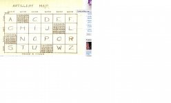
 ...Obee....as you are an ex-nine mile sniper...Arty.....you may have a clue on the Arty Map Code found on a dead WW11 carrier Pidgin .......I remember FOO's using up to 10 figure for a map reference for accurate targeting.....worked pretty well from the demo I saw......the code is different from a simple infantry field code in that it has the 4 ..multi numbered squares...the figures different in each down column....the Letters (A C D E) could stand for number or Letters....the numbered squares...repeat numbers ( a repeated number in a map reference )....The Lat and Long figures must hold a clue or is is just a simple 6 thousand by 4 thousand map square.....and the tgt's are the multi numbered squares ?.....ofcourse if you had an idea of what map was in use and the ops area..that would help heaps......being an Arty Code....and you guys work in lots of figures.....you would have a better idea how it work than the average Grunt......the 36000x22000 at the bottom of the map must have some meaning except for adding up the Long and Lat for someone who cant add...bit of a teaser....thought you might be interested ....TomB
