You are using an out of date browser. It may not display this or other websites correctly.
You should upgrade or use an alternative browser.
You should upgrade or use an alternative browser.
US Regular Army...1812... (1 Viewer)
- Thread starter mikemiller1955
- Start date
Jagdpanther
2nd Lieutenant
- Joined
- Jun 17, 2008
- Messages
- 3,154
Michael,
Thats an impressive amount of figures, looks good.
Thats an impressive amount of figures, looks good.
6th Wisconsin
Sergeant Major
- Joined
- Jul 2, 2008
- Messages
- 1,644
I did some photography at that very spot a few months ago. Unfortunately there were not any wonderful looking soldiers marching by. Nice photos and great collection!
mestell
Colonel
- Joined
- Feb 12, 2008
- Messages
- 9,324
Rich...I know you live around there...so your knowledge of geography is definitive...I will rename the picture Pikes Peak or Adirondack...hahaha...
thanks Mark...appreciate the comment...
Howard my cobber...^&grin...
John's figures and Ken's mat will make any picture look good...
but I will agree with you on one thing...
just like you...
"I am a good looking bloke"...hehehehe....^&grin...
I do hope to spend more time with you in Chicago...you're just in such high demand...it's hard to get close to you...


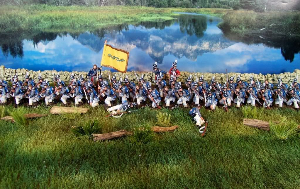
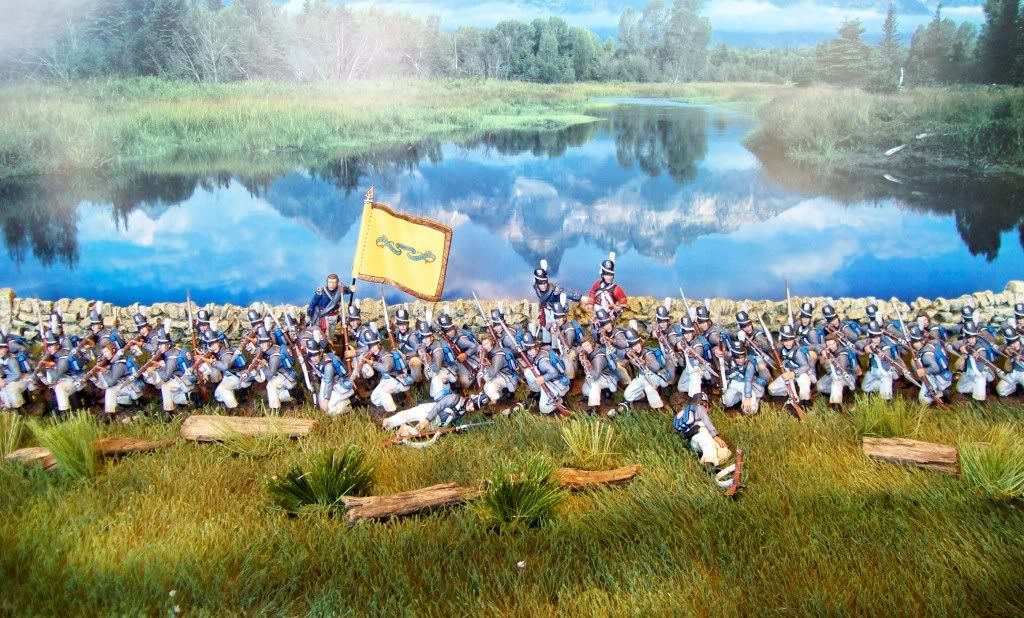
Just found your thread Michael. Very nicely done photos featuring your 1812 collection. These are the two I like best.
The first big set of rapids above Niagara Falls is at Chippawa. In my opinion, the rapids below the falls are more impressive simply because so much water is moving through such a narrow river channel. At Chippawa, the river is still wide and there is a large island in the river (think Navy Island). The link below is something close to the what is river is like at Chippawa. This is the tip of one of the islands in the river. The true width of the river is deep in the background.
http://www.google.com/imgres?imgurl...hl=en&client=safari&sa=N&rls=en&ndsp=18&tbs%3
A stretch of the lower river rapids is in the link below. Upstream of here, the rapids are more violent. When you look at the photo, you can see how incredibly narrow the river is when compared to the width of the upper river and the falls. That is the full width of the river. All the water going over both the American and Canadian Falls is funneled through that narrow river width. One side of the river is American soil, the other side Canada. I think the photo was taken from the Canadian side. That water is deep.
http://www.google.com/imgres?imgurl...&ndsp=18&tbs=isch:1&ei=GFmMTcDxEY7QgAexyamjDQ
Last edited:
Bah, I need to confess, my previous post was wrong. The battlefield is south of Chippawa Creek, not north. There the river is not in rapids. Swift current, but I do not think white water just yet. Niagara Falls is 3.1 miles to the northwest from the battlefield. The first large stretch of large rapids starts about 2.5 northwest of the battlefield.
This is a link to the battlefield site. Niagara Parks finally got around to purchasing the property in the 1995 (around 300 acres). You can see the river in the background. So I will make it Treefrog Official ---- Michael is now free to pop a canoe, whaleboat or any watercraft of his choosing into his dioramas.
Opposite the battlefield, the west channel of river is about 0.4 miles wide. Then you reach Navy Island (Canada) which is about 0.5 mile, then the eastern channel of the river which is again about 0.4 miles wide.
http://www.bing.com/images/search?q...5C14910BC5F5652B54C9F4627&first=1&FORM=IDFRIR
Last edited:
rpk
Private 1st Class
- Joined
- Jun 15, 2008
- Messages
- 207
Bah, I need to confess, my previous post was wrong. The battlefield is south of Chippawa Creek, not north. There the river is not in rapids. Swift current, but I do not think white water just yet. Niagara Falls is 3.1 miles to the northwest from the battlefield. The first large stretch of large rapids starts about 2.5 northwest of the battlefield.
There isn't white water yet in the area around Chippawa, the white water actually starts relatively close to the Falls around Goat Island and Three Sisters Islands. A good view of the Upper Niagara River before the Falls can be seen here. Those islands are definitely the place to go if you want to get right next to the rapids and both the Canadian and American falls.
This is a link to the battlefield site. Niagara Parks finally got around to purchasing the property in the 1995 (around 300 acres). You can see the river in the background. So I will make it Treefrog Official ---- Michael is now free to pop a canoe, whaleboat or any watercraft of his choosing into his dioramas.
Opposite the battlefield, the west channel of river is about 0.4 miles wide. Then you reach Navy Island (Canada) which is about 0.5 mile, then the eastern channel of the river which is again about 0.4 miles wide.
Just don't let the canoe or whaleboat go much beyond Navy Island, or they might be in for a rather rough ride! ^&grin Very strong currents. Grand Island is the big island that the Niagara River splits around before the Falls. The west river is named the Chippawa Channel and the east river the Tonawanda Channel. The Canadian border falls within the Chippawa Channel, with Navy Island on the Canadian side, and Grand Island on the US side. Definitely some nice views. I'll try to snap some pictures when things warm up (snow covered at the moment). I live on the south end of Grand Island, so can probably get some good views towards the Chippawa area in Canada. Living here I think I take it for granted unfortunately (haven't been to the Falls itself in a long, long time, even though it is just down the road
-Rich
Panzer Meyer
Sergeant
- Joined
- Sep 19, 2010
- Messages
- 766
Great work
Mike,
As it regards the rock walls that you show in back of the troop formation, every single agricultural field in that part of the world has those stacked limestone rock walls forming the perimeter on all 4 sides. Roads are lined by those rock walls. Constant feature of the landscape. The rock walls in your diorama are a very good representation of the rock walls in the Niagara Region.
There is so much scatter limestone in the glacial till of the area, you couldn't place an excessive amount of rock walls in a diorama if you tried. When God was raining on Noah, he "rocked" the Niagara Pennisula for 40 days and nights.
Users who are viewing this thread
Total: 2 (members: 0, guests: 2)

